All Spartina data collected by the BCSWG is uploaded to the Invasive Alien Plant Program (IAPP) database. This data is evaluated by the BCSWG to determine the abundance, distribution, and density of clones of Spartina spp. on a per-hectare basis. The evaluation described in the steps below helps the BCSWG determine the efficacy of the control methods it employs year-to-year as well as where to expend its efforts and resources for future years.
Step 1 - Delineate
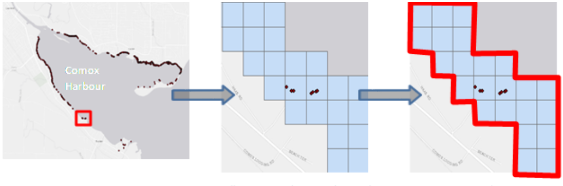
To start, coastal areas are delineated into zones whose boundaries mirror sites already delineated within the provincial IAPP database. From here, each delineated site is then divided into a grid of 1 ha cells.

Step 2 - Analyze
Following surveys, the BCSWG analyzes each IAPP sites by using several metrics:
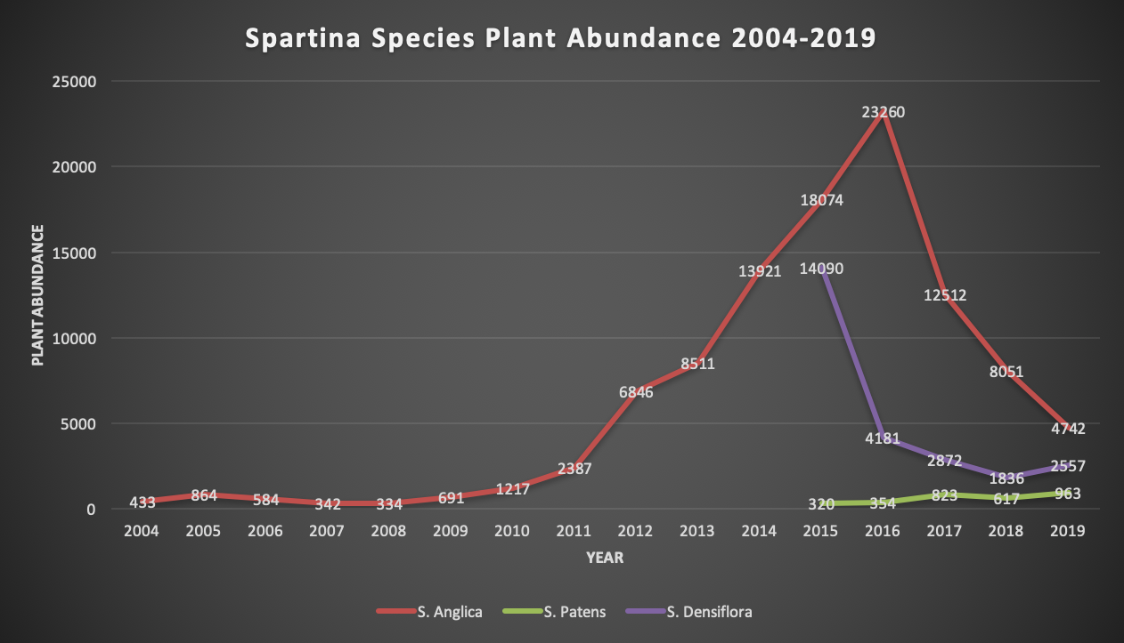
1. The number of plants or plant clones detected
1. The number of plants or plant clones detected
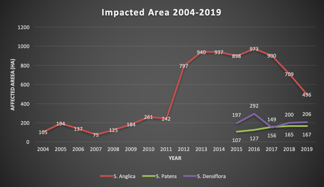
2. The number of hectare cells within each site boundary that contain Spartina Spp. known as "Impacted Area"
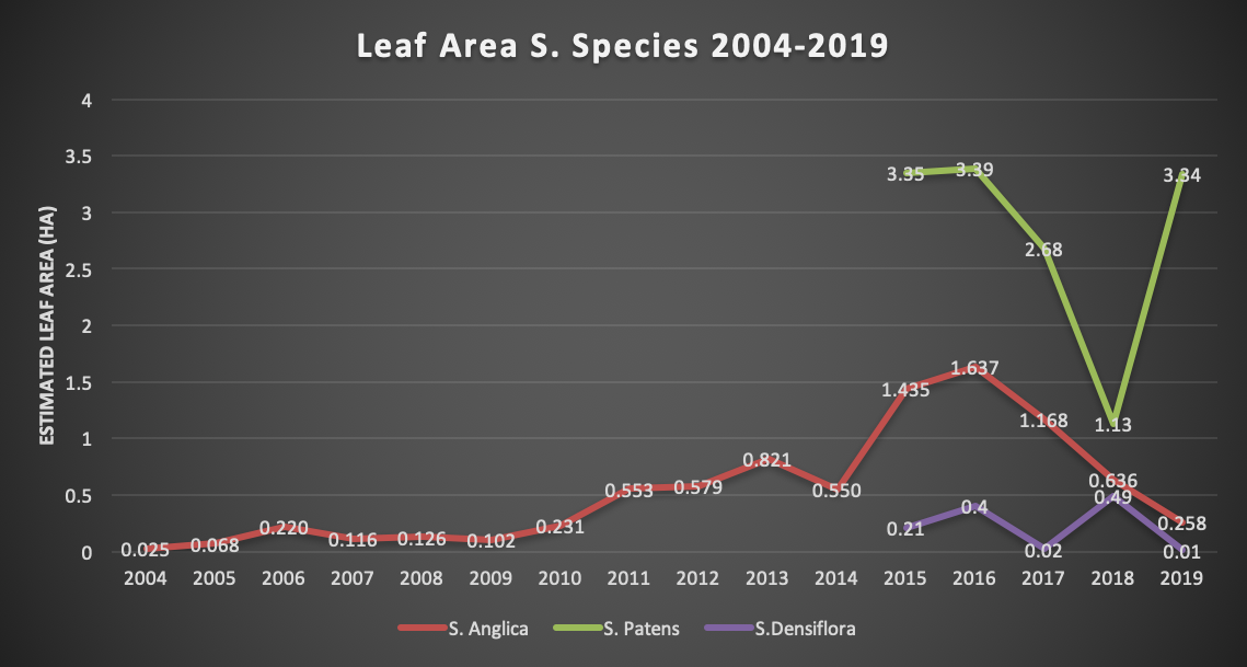
3. The estimated leaf area (number of plants or plant clones detected x size of each plant or plant clone = number of square meters a dispersed colony would occupy if all Spartina plants were grouped into a single cluster)
Step 3 - Summarize
The above metrics are summarized at a single cell (1 ha) level as well as an accumulation of all the cells within an IAPP site. These summaries are titled Cell Summaries and Site Summaries, respectively. With these summaries, the BCSWG determines how much shoreline has been impacted by Spartina spp. (how many 1 ha grid cells had one or more occurrences of Spartina).
Step 4 - Assess
Together, the metrics used by the BCSWG help depict spatial trends on a larger scale. By analyzing yearly data the BCSWG can effectively plan and develop monitoring and control activities for the future.
Step 5 - Monitor
The BCSWG monitors for many elements surrounding the restoration of BC's coastal ecosystems. Beyond the spread and reduction of Spartina infestations, the BCSWG monitors changes in elevation caused by Spartina and changes in native vegetation regimes. Finally, the BCSWG also monitors the progress of its active restoration sites, as described here.

